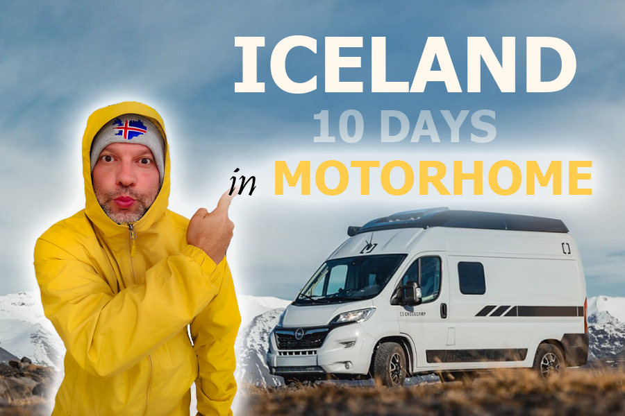


THE BEST 10-DAY CAMPERVAN ROAD TRIP ARROUND ICELAND
◊ TRAVELLING ALONG THE RING ROAD ◊
Published 21 OCT 2025
Iceland, one of the most fascinating and beautiful countries on our planet, an unforgettable land where ice and fire blend together to shape breathtaking landscapes.
One of the best ways to explore Iceland is by travelling along the Ring Road, the circular highway that loops around the island and gives easy access to most of the wonders this incredible country keeps tucked away in secret.
That’s why, over ten fantastic days, we set off in a campervan to travel across Iceland from north to south and east to west, falling under the spell of its charm and its fairytale-like scenery.
If you’re also thinking about embarking on a similar adventure, in today’s article, 10-DAY ICELAND ROAD TRIP BY CAMPERVAN, we’ll share the full itinerary of our journey through Viking lands, hoping it inspires you too, let’s go!
BEFORE SETTING OFF ON A CAMPERVAN ROAD TRIP IN ICELAND
The best time to travel around Iceland in a campervan is during the summer, between June and September, when most of the country’s main roads remain open.
However, although the weather is milder than at other times of the year, travelling to Iceland in summer doesn’t necessarily mean you’ll have good weather, as strong winds and rain are common all year round. That’s why I always recommend bringing winter clothing, walking boots, a jacket and a raincoat, along with lighter clothes for sunny days.
Another great advantage of travelling to Iceland in summer is that around the solstice, it never gets dark!, you can extend your days for as long as you wish, limited only by your need for rest. If you’re planning to visit in spring or winter, I’d suggest a five-day trip along the south coast instead.
To complete the full loop of the Ring Road, you need at least 10 FULL DAYS!, provided you’re travelling during the summer months. If you decide to travel in winter and plan a route similar to ours, due to the shorter daylight hours and to allow for any unexpected delays, I recommend having at least two to three extra days.
10-DAY CAMPERVAN ROUTE AROUND ICELAND
Our CAMPERVAN ROUTE AROUND ICELAND!, as I mentioned, was designed to be completed in ten full days between June and September, not including the flights to and from the country.
You don’t need to rent a 4×4 for this trip, as most of the route follows the Ring Road, a fully paved highway that circles the island and passes by some of Iceland’s most famous natural attractions.
One very important point to keep in mind when planning a campervan trip in Iceland is that since 2016, wild camping has been strictly prohibited. This means you need to find a campsite each night to stay.
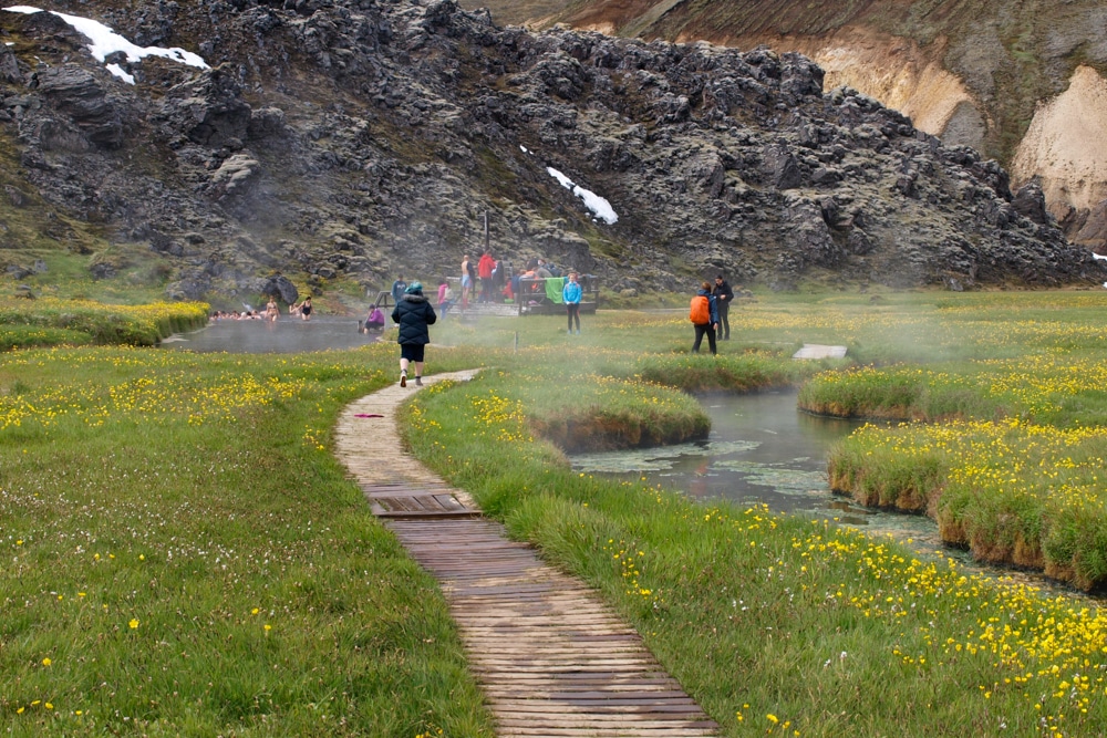
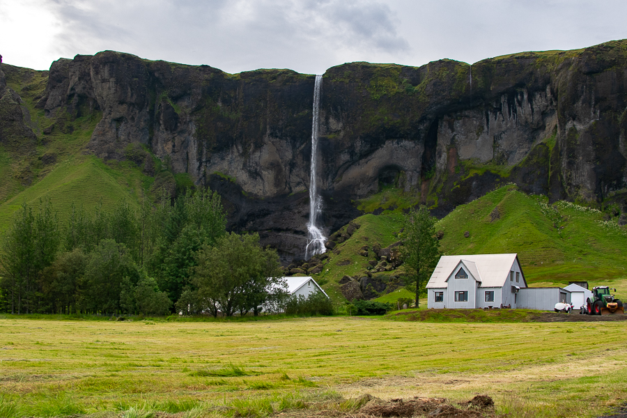
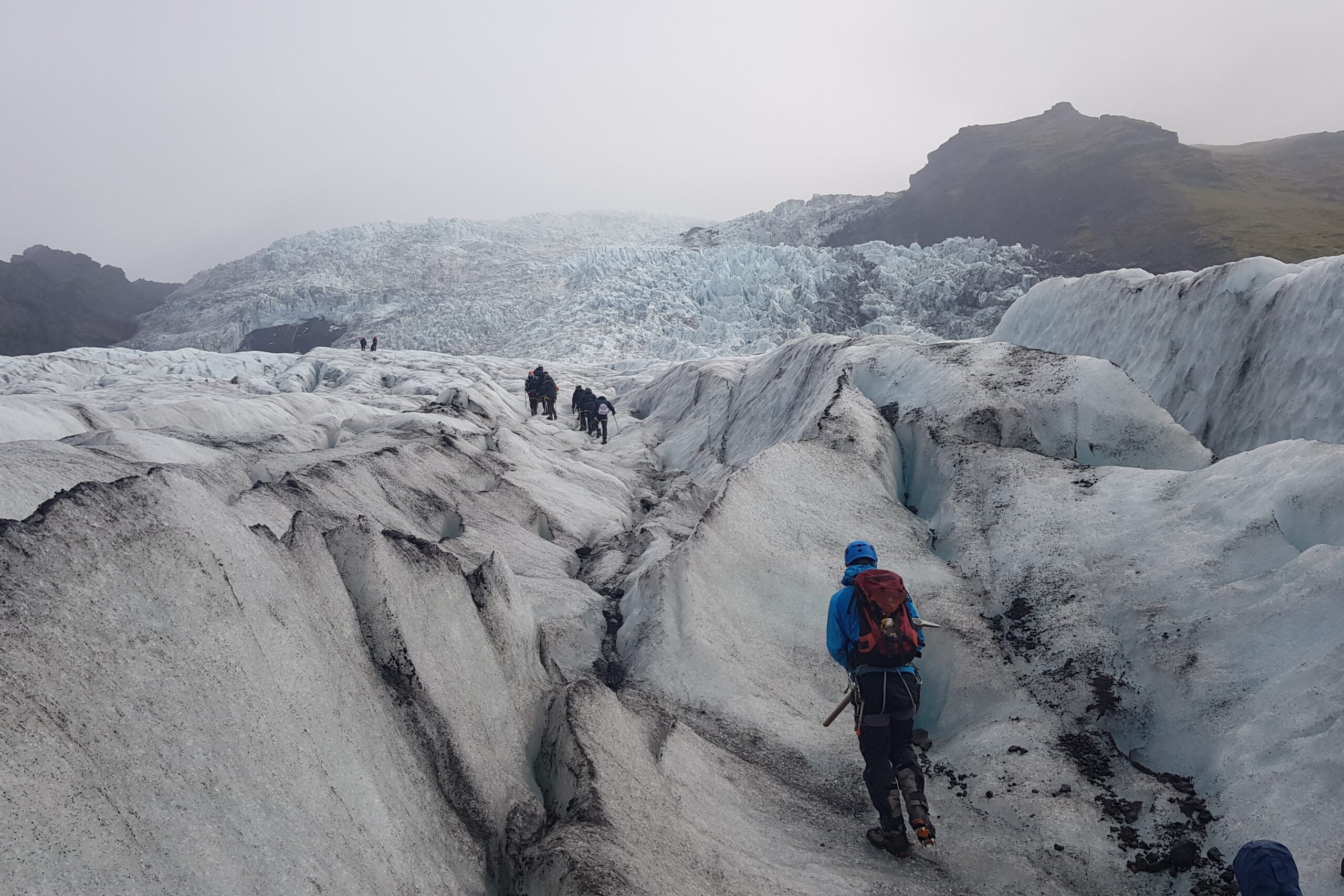
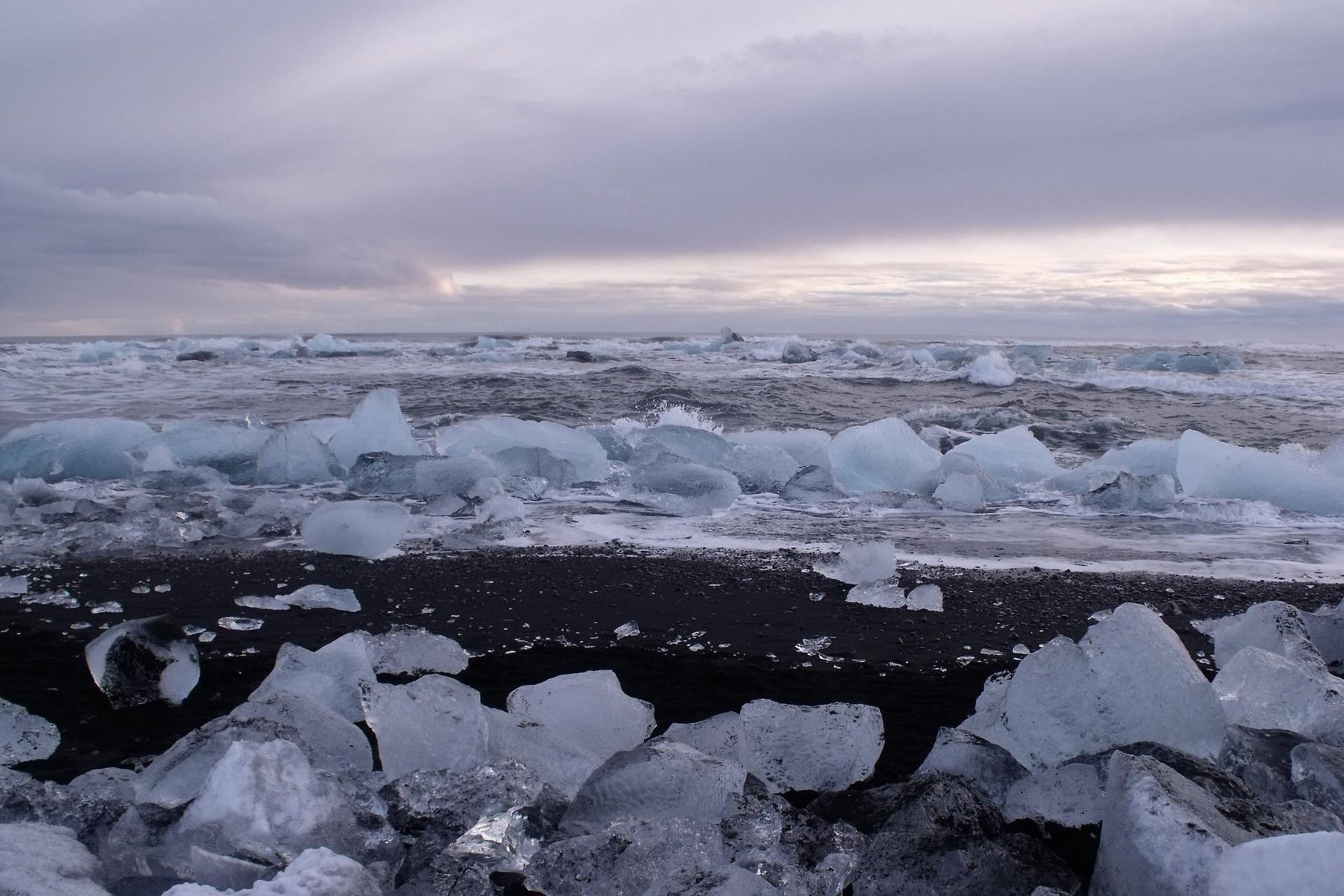
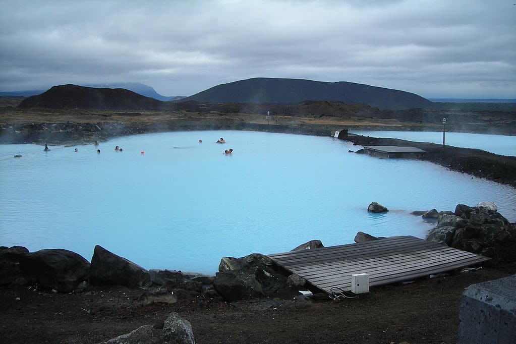
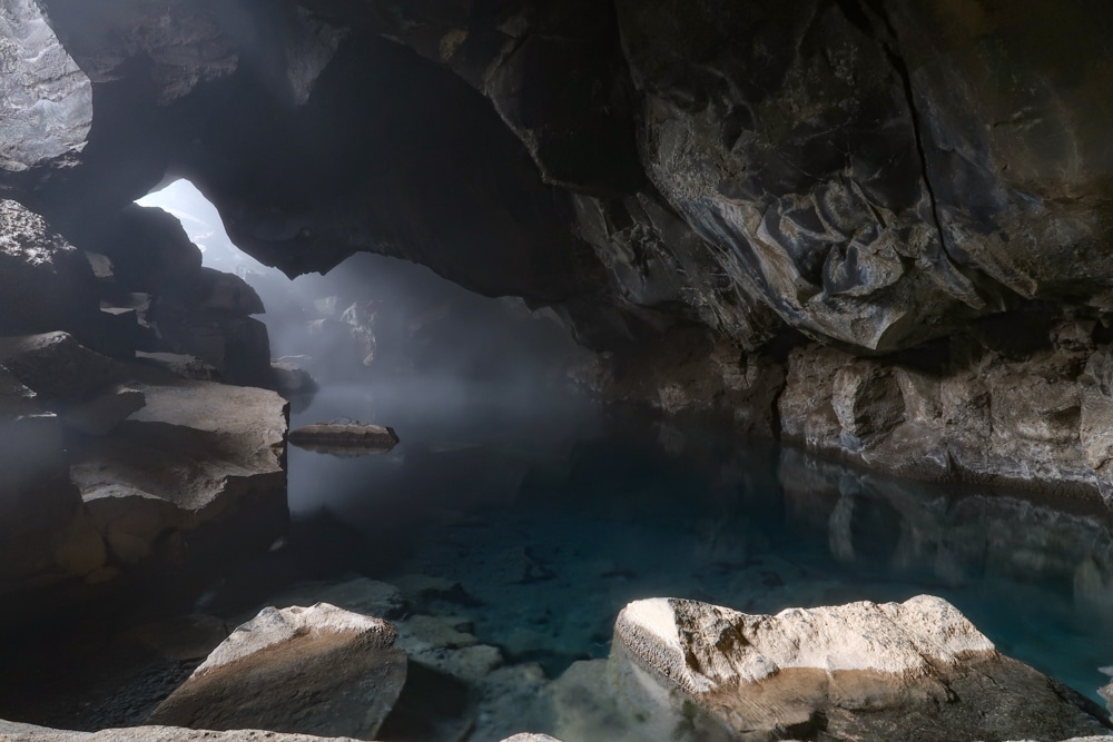
Our arrival in Iceland took place early in the morning. At Reykjavik Airport, we met with the team from Campervan Iceland, the local agency from which we were lucky enough to rent the campervan that would be our home for the next few days. At the end of this post, I’ll explain how you can book yours. Once all the paperwork was sorted, we set off towards the vast plain of Þingvellir, located about 14 miles east of Reykjavik along Road No. 36, near Þingvallavatn, Iceland’s largest lake. Þingvellir became Iceland’s first national park and remains one of the country’s most important historical sites. It was here, in the year 930, that the Alþingi was founded, one of the oldest parliamentary institutions in the world. While in the park, you should explore the fissures caused by the separation of the North American and Eurasian tectonic plates. It’s even possible to go snorkelling there. The area has many other attractions, such as the farm and church, the Almannagjá gorge, and the Öxarárfoss waterfall. Þingvellir forms part of the famous Golden Circle Route, a short circuit considered Iceland’s most popular and iconic sightseeing trail. After visiting the park, we continued to the second stop on the Golden Circle, the Haukadalur geothermal area. On the way, we made a quick stop by the turquoise waters of the small Brúarfoss waterfall. In Haukadalur, you’ll find Strokkur, the most reliable geyser in the world, whose boiling water column can reach up to 100 feet high. Very close by lies Geysir, the one that gave its name to all the geysers in the world. Unfortunately, it stopped erupting a few years ago. The third stop on the Golden Circle is Gullfoss, the Golden Waterfall. Its double cascade, dropping 105 feet in total, makes it not only a national symbol but also one of the most breathtaking sights in the country. On our way to Hella, a small village along the Ring Road, we made a brief stop at Kerið, the first of the volcanic craters we visited during the trip. If you have some time to spare, it’s also worth stopping by the Urriðafoss rapids. Þingvellir Almannagjá
Öxarárfoss Brúarárfos
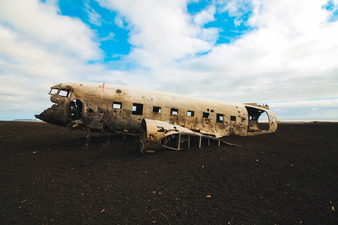
Strokur
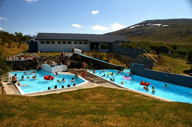
Gullfoss Cráter Kerið Urriðafoss Hella If there’s one thing that shouldn’t be missing from any trip to these lands, it’s an excursion to the famous Highlands. Their vast black sand deserts and misty, ice-capped mountains offer unforgettable and completely surreal landscapes. We decided to explore part of these lonely, rugged areas dominated by volcanic devastation by visiting Landmannalaugar, a mountainous region within the Fjallabak Nature Reserve. Thanks to the intense volcanic activity that characterises this area, the scenery is simply spectacular: vast lava deserts, multicoloured mountains, turquoise lagoons, fumaroles, sulphur pools, and a host of strange phenomena capable of transporting your imagination to a completely unknown and otherworldly place. However, to access the Highlands, you need a 4×4 vehicle, as the roads leading into Iceland’s interior are only suitable for such cars. If your campervan or caravan is suitable, you can reach Landmannalaugar independently. Otherwise, you’ll need to book a tour or take the return journey by bus. On the way, driving through the Thjorsardalur Valley along Route 26, we saw Hekla Volcano, whose name means “the hooded one” because of the unusual cloud that often covers its summit. At 4,891 ft (1,491 m) high, it’s Iceland’s most active and one of its most dangerous volcanoes. Once in Landmannalaugar, the best way to explore the region is on foot, choosing from the numerous hiking trails that cross its valleys and ochre-coloured mountains. We did the Laugahraun trail, which winds past solfataras and sulphur deposits up to the Brennisteinsalda viewpoint. Afterwards, we had time to enjoy our first hot spring baths of the trip—where? In the natural pools of Landmannalaugar, whose waters from a geothermal spring are warmed by glacial meltwater. I recommend checking out the next post, where you’ll find all the information you need to visit this remote central region of Iceland. Hekla Volcano F208 Landmannalaugar Landmannalaugar Hot spring On our third day travelling around Iceland in a campervan, we drove along the western stretch of the south coast via the Ring Road, visiting four of the country’s most famous and beautiful waterfalls. The first, Seljalandsfoss, is famous for the path that allows you to walk behind the cascade, which plunges into a pool of green water. Far less crowded and well known than the previous one, the eerie Gljúfurábui waterfall can be reached by following the dirt track that begins at the Seljalandsfoss car park and leads to the cave where it hides. We continued along the Ring Road to the Eyjafjallajökull Visitor Centre. Clearly signposted beside the main road, it sits at the foot of the volcano whose eruption in the spring of 2010 had devastating consequences. As with many other volcanoes in Iceland, it lies beneath a massive glacier that presses down on the crater, causing eruptions that are far more destructive and violent. Near the visitor centre, a rough gravel track leads to an abandoned farm, where a walking path follows the riverbed up to the Seljavallalaug Pool. This open-air swimming pool sits right at the foot of Eyjafjallajökull, where the haunting effects of the ash fall from the eruption that paralysed European airspace are still visible. Our next and final stop was at the campsite beside Skógarfoss Waterfall, which, with its 203 ft (62 m) curtain of water, is perhaps Iceland’s most famous and iconic waterfall. At the top of the falls begins the well-known Fimmvörðuháls Trail, the popular multi-day trek that takes three days to reach the Þórsmörk Valley and seven days to reach the Landmannalaugar campsite. The first stretch of the hike follows the Skógar River inland, forming numerous smaller waterfalls along the way. We walked about the first mile of the trail, where we saw several truly lovely falls. Roughly a mile east of the Skógar campsite lies Kvernufoss Waterfall, which you can easily reach on foot by following a path that winds up along the river. It’s not very well known and much quieter than the previous ones, though its beauty is beyond question. Seljalandsfoss Gljúfrabúi Eyjafjallajökull Seljavallalaug Skógarfoss Fimmvörðuháls Kvernufoss In the small village of Skógar, east of the waterfall, there’s a museum that recreates aspects of Icelandic life, including a church, a turf-roofed farm, and a transport museum. After visiting it, we continued along the south coast towards the small village of Vík í Mýrdal, near which we visited two of the most beautiful beaches in the world. On the way, we made a short stop at the base of the Sólheimajökull glacier tongue, which descends from the Mýrdalsjökull ice cap, beneath which lies one of Iceland’s most dangerous volcanoes, Katla. Nearby is the parking area for Sólheimasandur Beach. If you have time, you can stop to visit the remains of the famous DC-3 plane wreck. The walk from the car park, now clearly signposted, takes around two hours round trip. Alternatively, you can book a spot on the shuttle bus, which takes about 15 minutes each way. Around Vík, we made three stops. The first two involved taking the turn-off onto Route 218 to visit the black sand Kirkjufjara Beach and its striking lava formations, an important nesting area for the famous puffins, Iceland’s national bird. Before reaching the car park, a dirt track to the right leads up to the Dyrhólaey viewpoint, one of the most iconic rock formations along the south coast. The final stop was at the black sand Reynisfjara Beach, accessed via Route 215. Located next to the Reynisdrangar sea stacks and an impressive collection of basalt columns, it is considered Iceland’s most beautiful beach. After that, we continued towards Skaftafell National Park, though along the way it’s worth making brief stops at three other points. The first is to admire the Fjaðrárgljúfur Canyon, reached via the turn-off from Route 206. The second stop was near the village with the unpronounceable name, Kirkjubæjarklaustur. Close to the petrol station along the road, beside some information panels, a hidden path leads to Kirkjugólf, which literally translates as “Church Floor.” The name comes from the basalt columns embedded in the ground, resembling the floor of an ancient cathedral. Continuing along the Ring Road, 11 kilometres further, we came to Foss á Síðu, a waterfall that plunges 98 ft (30 m) over a basalt cliff. A unique feature of this beautiful waterfall is that strong southerly winds can sometimes push the falling water back upwards. Skógar Museum Solheimajökull DC3 Plane Kirkjufjara Dyrhólaey Reynisfjara Fjaðrárgljúfur Kirkjugólfr Foss á Síðu Skaftafell National Park is one of the most popular destinations in southern Iceland. It offers a wide range of outdoor activities, such as hiking trails, cycling, and glacier walks on Vatnajökull. One of the most accessible paths with the best views is the trail to Svartifoss Waterfall—another of Iceland’s most famous and beautiful falls. The walk from the camping area takes around 1 hour and 30 minutes, though the route can be extended to the moraines of the Morsárjökull Glacier, just as we did. Another popular and easy hike leads to the base of Skaftafellsjökull Glacier. It follows flat terrain, making it very simple to complete. After visiting the park, we continued east along the Ring Road, where numerous glacier tongues descend from the Vatnajökull Ice Cap, the largest ice cap in the world outside the polar regions. About 29 miles (47 km) along the route, you’ll find Fjallsárlón Glacier Lagoon, where floating icebergs break off from the Fjallsjökull Glacier. A few miles further east is a much larger lagoon, Jökulsárlón, where kayaking trips are available. You’ve probably seen hundreds of photos of this place, as it has become one of Iceland’s iconic locations. Its icebergs are pushed by the current onto a nearby black sand beach, Diamond Beach. Svartifoss Morsárjökull Skaftafeljökull Glacier hike on Vatnajökull trekking Fjallsárlón Jökulsárlón Diamond Beach Our sixth day on the road began with a bath in the hot pools of Hoffell Guesthouse, located near the town of Höfn, which, with its 1,640 inhabitants, is considered the most important settlement in the southeast of Iceland. Here, we rejoined the Ring Road and travelled along part of Iceland’s eastern coast until reaching the village of Reyðarfjörður. Over these roughly 145 miles, we passed through several lovely fishing villages, following the line of the Berurfjörður fjord, then Fáskrúðsfjörður, and finally Reyðarfjörður, where you take the tunnel connecting to the town of Egilsstaðir. Next, I recommend taking road no. 95, which turns south before joining road 931, skirting the Lagarfjöt lake and crossing to the opposite shore, where we parked in a small gravel car park. From here begins a 3-mile round-trip hike that climbs to a deep canyon where Hengifoss plunges down, its 394 feet making it the third-highest waterfall in Iceland. Halfway up, you’ll find Litlanetfoss, another waterfall of much smaller size, which carves its way through numerous basalt columns. After visiting both waterfalls, we returned to the Ring Road to drive the 100 miles separating us from the Grímsstadir campsite, located on the edge of the Jökulsargljúfur National Park. Hoffel Fáskrúðsfjorður Reyðarfjörður Litlanetfoss Hengifoss During our seventh day travelling around Iceland by campervan, we visited two beautiful waterfalls formed by the Jökulsá á Fjöllum river, which along its course carves the impressive Ásbyrgi canyon before finally flowing into the Arctic Ocean. There are two ways to reach both waterfalls. The first is via road no. 864, near the Grímsstaðir campsite, which runs along the eastern bank of the river. However, we recommend taking road 862, which is better paved, follows the western side, and offers superior views compared to the opposite bank. From the car park, we walked to two of Iceland’s most famous waterfalls. The colossal Dettifoss, which at 144 feet high and 328 feet wide is the most powerful waterfall in Europe. The second, Selfoss, is smaller but equally beautifully striking. Continuing west along the Ring Road, we reached the turn-off for the Krafla volcanic area, where we took the road leading to the Leirhnjúkur car park. From there, we explored on foot part of its cracked volcanic caldera, full of craters and steam vents. A few metres away, there’s another car park where we stopped before continuing on foot to the rim of the Viti crater, whose interior contains an astonishing turquoise lagoon. Right on the Ring Road, opposite the Krafla turn-off, lies the wonderful multicoloured field of Hverir. This surreal landscape of ochre tones combines boiling mud pools, bright blue lagoons, sulphur deposits, and many other unusual geological phenomena. By late afternoon, the best place to rest and relax is at the popular Mývatn thermal baths, whose waters are known for their healing properties. It’s important to note that tickets must be booked in advance for a specific time slot. Dettifoss Selfoss Krafla Viti Crater Hverir Myvatn Nature Bhats On the morning of our eighth day, we explored the surroundings of Lake Mývatn, one of the most exotic places in northern Iceland. The first site we visited was the Grjótagjá fissure, a cave whose interior hides hot springs with a temperature of around 113°F. This is where some famous scenes from the popular series Game of Thrones were filmed. Another of the most impressive places to see here is the titanic Hverfjall caldera, a gigantic volcanic cone rising more than 1,520 feet high. Next to its southern slope lie the “sculptures” of Dimmuborgir, an irregular lava field filled with beautiful and strange formations, the result of an eruption more than 2,000 years ago. After visiting these three sites, we returned to the Ring Road. Skirting the southern shore of Lake Mývatn, we saw the pseudocraters of Skútustaðagígar. Afterwards, we continued for about 24 miles to Goðafoss, whose name literally means Waterfall of the Gods, and which is among the most photographed in Iceland. Our next stop was at the Hofsós geothermal pools, for which we continued along the Ring Road, passing through the city of Akureyri. Resting on the shores of the North Sea at the foot of snow-capped mountains, this town of 17,300 inhabitants is considered Iceland’s second-largest settlement. Finally, before reaching the Langafit campsite, we turned onto road 711 towards the peculiar rock formation of Hvítserkur, located on the shores of the Vatnsnes peninsula. Grótágja Hverfjall Dimmuborgir Skutustadagigar Goδafoss Hofsós Pool Hvítserkur On the penultimate day of our Iceland campervan route, we took road no. 50 to reach the small town of Reykholt, one of Iceland’s most important medieval settlements, whose surroundings hide several fascinating places. First, we visited the Víðgelmir lava tunnel, a 1-mile-long cave located on private land. To enter, you must head to Fljotsunga farm, where the owners organise guided tours inside the cave. We then made our way to Húsafell, a recreational area very popular among the residents of Reykjavik. In addition to its excellent geothermal pools, this is also the starting point for guided tours to the ice caves of the Langjökull glacier, the second largest in Iceland. Before continuing back towards Reykjavik, we made a brief stop about 4 miles west of Húsafell to see Hraunfossar, a unique waterfall whose waters emerge directly from the lava formations of Hallmundarhraun, created by eruptions from volcanoes hidden beneath the Langjökull glacier. Next to it are the Barnafoss rapids, sculpted by the strong current of the Hvítá river. Vídgelmir Húsafell Pool Hraunfossar Barnafoss Our final day in Iceland gave us the chance to discover some of the most iconic spots in the capital, Reykjavik. Its name, which in Icelandic means “Smoky Bay”, comes from the columns of steam that rise from the ground beneath the city. Around 122,000 people live here permanently, roughly a third of the country’s total population. Although Reykjavik doesn’t boast an overwhelming historical tradition or world-famous monuments, I can assure you that you’ll feel truly fortunate to experience it. The historic centre can easily be explored in a single morning, so one day in Reykjavik is more than enough to get to know the city and even enjoy an alternative plan or two. If you don’t want to spend too much time there, a great option is to book the classic walking Tour. In the afternoon, we took the opportunity to relax in the waters of the Blue Lagoon, the number one tourist attraction in the country. It’s located about 42 miles south of Reykjavik, on the Reykjanes peninsula. If you decide to go and visit during the summer months, I recommend booking your tickets in advance. Reykjavik Hallgrímskirkja Sólfar Blue Lagoon Como dije al principio del post y como su nombre indica, para nuestro viaje decidimos alquilar una autocaravana. Sin embargo, para hacer un road trip como el nuestro también puedes optar por una camper, ello dependerá del número de personas que compongáis el grupo y de vuestro presupuesto. Dicho lo cual, alquilar una caravana o campervan en Islandia es sumamente sencillo, pero también muy caro. Sin embargo, dado el alto precio de los alojamientos en Islandia, siempre resultará mucho más económico que viajar contratando un turismo convencional y durmiendo en hoteles. En algunas zonas del país el precio medio por noche puede llegar a rondar incluso los 400 euros. A la hora de reservar recomendamos que lo hagáis con Campervan Iceland, nuestra experiencia con ellos fue sencillamente perfecta. Además de ofrecernos el mejor precio y disponer de atención permanente durante las 24 horas, el trato fue inmejorable y super cercano. Se trata de una compañía local con quienes colaboran Alberto y Miguel, desde entonces, dos amigos afincados en Reykjavik con quienes sigo manteniendo amistad y una estrecha colaboración. En el siguiente post te ayudo a escoger la caravana o campervan que mejor se adapte a tu presupuesto y necesidades. And before moving on, don’t forget to take a look at the MAP OF OUR 10-DAY ICELAND CAMPERVAN ROUTE! It will be a great help during both the planning and the course of your trip. Remember, you can share it on Google Maps using the “Share – Add to My Maps” option. This way, you’ll have all the locations downloaded in your app, which will make getting around much easier once you’re on site. What did you think of today’s article, 10-DAY ICELAND ROAD TRIP BY CAMPERVAN? Comment, share it on your social media, follow our adventures on Instagram, and help us improve.![]()
![]()
10-DAY ICELAND ROAD TRIP BY CAMPERVAN, DAY 1


10-DAY ICELAND ROAD TRIP BY CAMPERVAN, DAY 2


10-DAY ICELAND ROAD TRIP BY CAMPERVAN, DAY 3


10-DAY ICELAND ROAD TRIP BY CAMPERVAN, DAY 4


10-DAY ICELAND ROAD TRIP BY CAMPERVAN, DAY 5


10-DAY ICELAND ROAD TRIP BY CAMPERVAN, DAY 6


10-DAY ICELAND ROAD TRIP BY CAMPERVAN, DAY 7


10-DAY ICELAND ROAD TRIP BY CAMPERVAN, DAY 8


10-DAY ICELAND ROAD TRIP BY CAMPERVAN, DAY 9


10-DAY ICELAND ROAD TRIP BY CAMPERVAN, DAY 10


DÓNDE ALQUILAR UNA AUTOCARAVANA O CAMPERVAN EN ISLANIDA
![]()
![]()
MAP OF OUR 10-DAY ICELAND CAMPERVAN ROUTE


